It’s
been a long time since my previous post. Meanwhile I have been
mostly
working with non-canopy problems, especially lidar-based forest inventory. I’ve also
had some teaching and supervision responsibilities, and a six-month visit to
Norwegian University of Life Sciences, where I (for a change) had plenty of
time for research. Thus I finally got out the first paper based on our 2011 field campaign: crown volume estimation using airborne lidar data.
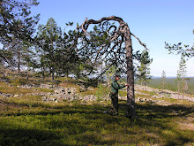
The
roots of this study go back to 2005 when I collected data for my master’s
thesis at Metla’s Suonenjoki research station. Pola and Miina had employed
three students to work there, and one of us, Sanna, made some curious
measurements using an instrument called angle measurer (a.k.a. “miinaharava”). It is a T-shaped stick that can be used to measure
crown widths at different heights, enabling estimation of vertical canopy
profiles and crown volume. The data was
needed for developing spectral reflectance models – some papers have been published
in AFM and Silva Fennica.

The angle measurer

Example of a crown profile.
Sanna’s
work came back to my mind later when I learned what a colleague of mine at
the UEF, Jari Vauhkonen, was studying. Jari worked with detecting individual
tree crowns from airborne lidar data, and was the first person to test the alpha shape method in the prediction of tree attributes. Alpha shapes are a method that
can be used to combine a set of 3D points into one geometrical shape, which is
defined by the alpha parameter. The volume of the shape can be calculated
based on the triangulation of its individual points (=lidar echoes). Thus, when
the echoes represent a tree crown, its volume can be estimated automatically. Our
idea was to validate these estimates using the angle measurer.
Thus Juha
and Laura measured the crown volumes of 89 trees during the 2011 field
campaign. 77 of these trees were detected from the lidar data and used in the
analysis. The echo segmentation phase was somewhat laborious, as my automated
algorithm did not always delineate the tree perfectly and plenty of manual work was needed
to remove this error source (and actually this had to be done several times
because of some personal blunders and errors in the lidar data preprocessing).
Based on the delineated echoes, Jari calculated the crown volumes and we simply
plotted them against field-measured values. The results showed that the
lidar-based volumes were clearly smaller than field values, mainly because
there were not enough echoes from the lower part of the crown. Yet the results
were better than those obtained using a general model for the crown dimensions and assuming
an ellipsoidal crown shape. Full paper can be read here.
This simple experiment is anyway a step into a direction that is very
interesting to me – using features derived directly from the lidar point cloud
instead of predictions based on forestry databases. Most of the existing
theoretical forest models use traditional forest attributes such as tree density,
height, and basal area, which are increasingly estimated using lidar, so why
not directly use lidar point cloud features instead? One problem is that the
lidar features can be sensitive to scanner settings. Nevertheless, in my opinion more
this kind of investigations should be made in the near future.