My thesis project was finally finished a month ago and now it is time to think of something new. May was really busy, because I had three projects going on simultaneously: preparing for final exams needed for PhD, planning the field campaign scheduled to start in June, and the seedling stand inventory project, for which I mainly work at the moment.
The seedling-laser project is aimed at predicting the seedling stand management need directly from laser data and aerial images. An expert forester determined management need categories (urgent / five years / no need) for each of 238 sample plots in our data. The problem is to make the supervised classification work so that this training data could be used to predict the management need for new stands. Basically, we need to determine which remotely sensed features provide the best class separability, and which analysis methods or models work the best. This is quite difficult, as the classes are defined subjectively and overlap heavily. Nevertheless, it seems to be possible to detect at least the recently managed stands, as well as the stands where conifer seedlings are heavily shadowed by rapidly growing deciduous species.
The seedling-laser project is aimed at predicting the seedling stand management need directly from laser data and aerial images. An expert forester determined management need categories (urgent / five years / no need) for each of 238 sample plots in our data. The problem is to make the supervised classification work so that this training data could be used to predict the management need for new stands. Basically, we need to determine which remotely sensed features provide the best class separability, and which analysis methods or models work the best. This is quite difficult, as the classes are defined subjectively and overlap heavily. Nevertheless, it seems to be possible to detect at least the recently managed stands, as well as the stands where conifer seedlings are heavily shadowed by rapidly growing deciduous species.
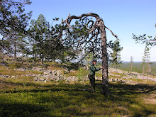
From the LAI Detectives' viewpoint, the Toplaser-project field measurements are more interesting, as they are a direct continuation for my earlier work with canopy measurements. Two students are working at Hyytiälä for two months - apparently I've become too well educated to work in the field for longer periods... First, they rephotograph the 2008 hemispherical image plots that has already been used in two papers by me and Janne. They also make tree level crown shape and transparency measurements. This data should be very useful for studying the canopy structure with full-waveform LiDAR data. There will be plenty of calculations and analysis next winter!

Juha measures crown shape
In addition, during the week I spent supervising the workers at Hyytiälä, I helped Ilkka to establish a special close-range photogrammetry experiment in the forest. We placed some calibration targets high into the canopy, measured their coordinates with a tacheometer, and took photos of them from carefully located image points. This should enable us to visualize the LiDAR waveforms in the images, like in this experimental photo where you can see the waveforms of some LiDAR pulses from the building and ground. Extremely interesting!

Intensity peaks at ground and roof edge

Calibration targets in up in the trees
Before my vacation starts in the middle of June, there's also some teaching in sight. I'll work as an assistant teacher in the field course for the UEF first-year forestry students at Mekrijärvi research station. The course is quite the same as it was back in 2002 when I passed it myself: students learn to use relascopes, calipers, hypsometers etc. It is interesting to see how the students are able to apply the theory taught in the winter in a real forest.
Have a nice summer!