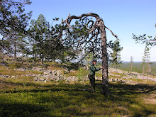
After a successful field (and holiday) season that had started already in early may, I returned to my office in mid-september. Then I started to realize that I had several gigabytes of raw data that needed to be analyzed: hemispherical images, wide angle aerial images, GPS and laser measured positions, stand- and plotwise forest inventory data, crown radius measurements, individual tree measurements… I was of course aware that it would take several weeks to go through it all, but I was not quite able to see that it would last until today, 19. December, to finally have it all neatly in (less than five) spreadsheets! So the autumn has been mostly copying data from one place to another, running some analysis, and then copying again. Of course there were also some more pleasant (coding) phases when a feeling of creating something new occasionally emerged, but what I’m likely to remember afterwards are the endless rows of data – and the particularly frustrating task of bug fixing! But now it’s finished, and next year there will be plenty of “real” research to be done.
Merry Christmas and happy New Year!
Height modeling

Tree positioning

Crown mapping

Image thresholding

